Shapefiles
Advertisement
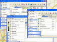
RoboGEO
Geocode photos (including RAW) from a GPS. Stamp the images or write (lossless) to the EXIF headers. Create web pages using Google Maps, export KML/KMZ files to Google Earth, upload to Flickr, export shapefiles (SHP) or AutoCAD DXF files. Supports Garmin
Advertisement
AnyChart Flash Map Converter v.1.0.4
Convert ESRI ShapeFiles (.SHP) geolocation data into AnyMap format to be used with AnyChart. AnyChart Flash Map Converter allows making use of a wide choice of maps with AnyChart, a GIS system that recognizes map data in AnyMap format only.
KML Feature Extractor v.1.0.1
KML Feature Extractor is a program designed to extract the features of KML/KMZ files (the native format of Google Earth). The program will scan for features, extract them, and convert them to shapefiles.
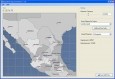
SHPTRANS v.1. 1. 2004
SHPTRANS is a fast, high-precision NTv2 datum transformation and projection utility which reads and writes shapefiles. SHPTRANS is intended to complement, not replace, existing projection tools such as those within ArcView GIS 3.x and ArcGIS 8.x.
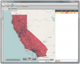
GSpatial Toolbar v.2. 2. 2004
ESRI shapefiles are a very common mapping or GIS dat exchange format. Google Earth uses an exchange format called KML, which is a variant of XML.
OpenJUMP v.1. 4. 2002
OpenJUMP is an open source Geographic Information System (GIS), it can read and write shapefiles and simple GML files. It has limited support for the display of images and good support for showing data retrieved from WFS and WMS web-services.
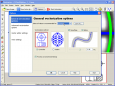
Manco Shapefile Editor v.1.0.0.0
Manco Shapefile Editor is a powerful tool for creating and editing shapefiles, with easy, almost ?on the fly?, geometry and data editing and possibility of direct creation of the shapefiles from the image files by image processing algorithms.
AnyChart Map Converter v.1.0.3261.26913
Visualize geolocation data in ESRI ShapeFiles format. AnyChart Map Converter utility is designed to convert ESRI ShapeFiles (*.shp) into the special AMAP format for using in the geo map module of AnyChart Flash Component - AnyMap.
GPX Converter for ArcGIS v.2.0
GPX Converter for ArcGIS can convert GIS files to GPX format, allows for easy conversion of your GIS data (shapefiles, featureclasses in a geodatabase and other formats supported by ArcGIS) to GPX format (the GPS Exchange Format).
OSM2SHP Java v.1.0
A very simple command line tool to convert OSM files to Shapefiles.
Vextractor v.6.50
Vextractor is a vectorizer program for transforming raster images to vector formats. This tool could be used for the vectorizing of drawings, maps, photo, logotypes and other line art images for input to CAD, GIS or Vector Graphics Design software.